
Meteorologist Marvin Gomez is tracking inches of snow expected in many places Tuesday evening into Wednesday morning. Here’s the latest on the First Alert.
This article is no longer being updated. Get the latest updates on the winter storm here.
What to Know
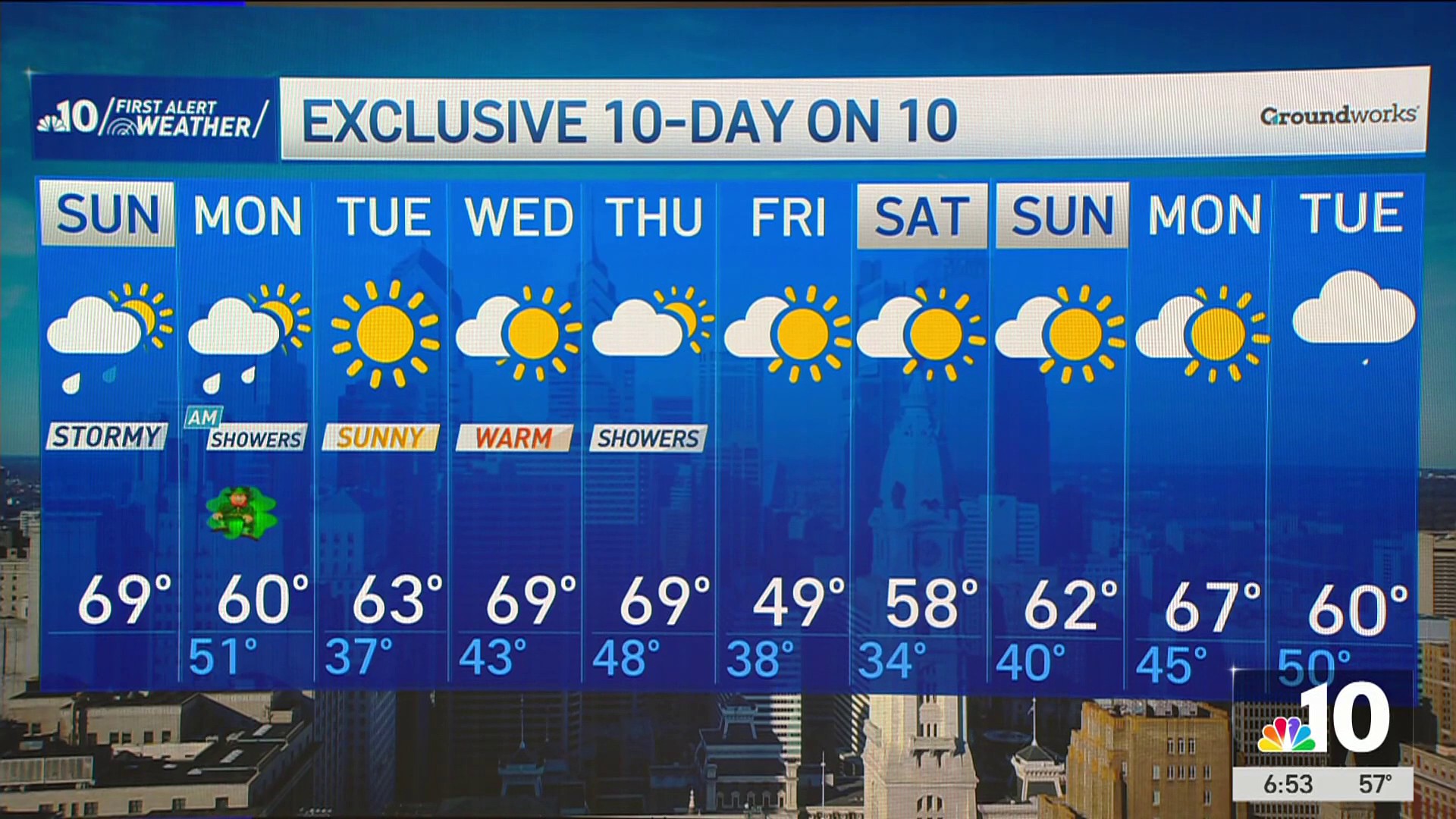
- We're in for more wintry weather this week, with snow expected to arrive Tuesday night.
- The First Alert Weather Team has issued a First Alert for accumulating snow and hazardous travel for South Jersey, Delaware, Philadelphia and the immediate Pennsylvania suburbs from 4 p.m. Tuesday, Feb. 11, 2025, through 7 a.m. on Wednesday, Feb. 12.
- Read on for details on the neighborhoods most likely to get around half a foot of snow and which spots will get next to nothing.
We’re in for more rounds of snow and icy weather in the Philadelphia region this week.
The first blast of wintry weather arrives later on Tuesday.
Get top local stories in Philly delivered to you every morning. Sign up for NBC Philadelphia's News Headlines newsletter.
The First Alert Weather Team has issued a First Alert for accumulating snow and hazardous travel for South Jersey, Delaware, Philadelphia and the immediate Pennsylvania suburbs from 4 p.m. Tuesday, Feb. 11, 2025, to 7 a.m. on Wednesday, Feb. 12.

Here's your guide to the snow, how much of it you might get and when more wintry weather is expected to arrive.

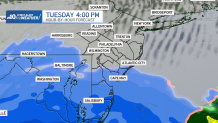
Snow starts in Delaware and New Jersey Tuesday afternoon, evening
A winter storm will bring another round of accumulating snow late Tuesday afternoon through Wednesday morning’s commute, creating hazardous travel conditions across the region.
The National Weather Service issued a Winter Storm Warning for Tuesday afternoon through Wednesday afternoon for the southernmost Jersey Shore communities and central and southern Delaware. Travel in those areas could be difficult during the heaviest snowfall.
A Winter Weather Advisory is in effect for Philadelphia, the immediate Pennsylvania suburbs, South Jersey and northern Delaware.
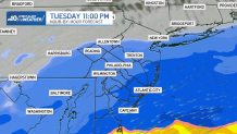
A storm developing over the Deep South will send moisture northward, with snow beginning late Tuesday and continuing overnight into Wednesday morning. The snow starts in Delaware and New Jersey in the late afternoon before spreading north during the evening.
What areas will get the most snow? ❄️
The heaviest snowfall is expected across Delaware and southern New Jersey, especially near the shore, where more than half a foot of snow could fall.
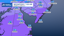
Closer to Philadelphia and the I-95 corridor, expect 2 to 4 inches, with a coting to 2 inches likely across the Lehigh Valley.
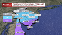
Here are the expected snow totals as of Sunday, Feb. 9, 2025:
Southern Delaware: 6 to 8 inches
Central Delaware, South Jersey, Jersey Shore: 4 to 6 inches
Northern Delaware, South Jersey: 3 to 5 inches
Philadelphia, I-95 corridor: 2 to 4 inches
Pennsylvania suburbs, Central Jersey: 2 to 3 inches
Lehigh Valley, Berks County: coating to 2 inches
Travel will be hazardous Tuesday night into Wednesday morning, especially south and east of Philadelphia, where snowfall rates may be moderate to heavy at times. Roads could become snow-covered and slippery, making for a challenging commute.
As the storm moves out around daybreak Wednesday morning, conditions will improve, but lingering snow and icy spots may still cause travel issues. Most will wake up to snow-covered cars, walkways and driveways, requiring cleanup before heading to work or school. School delays can't be ruled out.
More wintry weather on the way
Any snow that sticks on the ground will be washed away by cold rain late Wednesday night into Thursday morning. However, northern neighborhoods could get some icy precipitation during that second storm.
Then, stay tuned for a wintry mix on Saturday with rain last into Sunday.
Luckily, skies should be clear for Friday's Eagles Super Bowl parade through Philadelphia.
Get the latest updates on the storm by downloading the NBC10 app and following the NBC10 First Alert Weather Team.
Sign up for our Breaking newsletter to get the most urgent news stories in your inbox.