


High waters on the Schuylkill Expressway caused traffic to slow down when the first round of storms started Sunday evening. Areas like Bala Cynwyd saw downed trees and electrical wires which cause many to lose power. NBC10’s Leah Uko has more on the damage caused by the storm.
NBC10's First Alert Weather team issued a First Alert for Sunday as storms -- and severe weather -- moved through the region during the afternoon.
Damaging winds, flooding and power outages were seen in some parts of the region like the Lehigh Valley and Montgomery County.
Storms leading into Sunday
The weekend kicked off with cloudy skies and warmer temperatures before severe thunderstorms passed through on Saturday night.
Get Philly local news, weather forecasts, sports and entertainment stories to your inbox. Sign up for NBC Philadelphia newsletters.
The National Weather Service issued a severe thunderstorm watch for our region that was in effect until 11 p.m. Saturday night but canceled it just before 10 p.m.
This round of severe weather pushed to Philadelphia into Sunday morning.
The system weakened as it made its way down into southern New Jersey and northern Delaware.
Weather Stories


Of greater concern for our entire area are the storms that are forecasted to arrive Sunday later in the afternoon and evening.
Severe weather Sunday
Sunday started mostly cloudy but sporadically became sunny. This charged up the atmosphere for severe weather later in the day.
The NBC10 First Alert Weather team issued a First Alert for the threats of damaging winds, hail and a potential tornado.

A silver lining in the forecast was the persistent cloud cover over the region. With clouds hanging tough, temperatures were held down a bit, and energy in the atmosphere was reduced. However, humidity remained high.
As expected, stormy weather moved in during the late afternoon, bringing downpours and lightning strikes.
Storms spread from the northwest to the southeast.
Higher temperatures on Sunday will easily reach mid-90s with feels like temperatures reaching over 100 in some neighborhoods.
The storms spread to South Jersey and Delaware after tearing through the Lehigh Valley, Philadelphia and the Pennsylvania suburbs.
In parts of Montgomery county, power was knocked out, tree limbs were downed and there was some localized flooding.
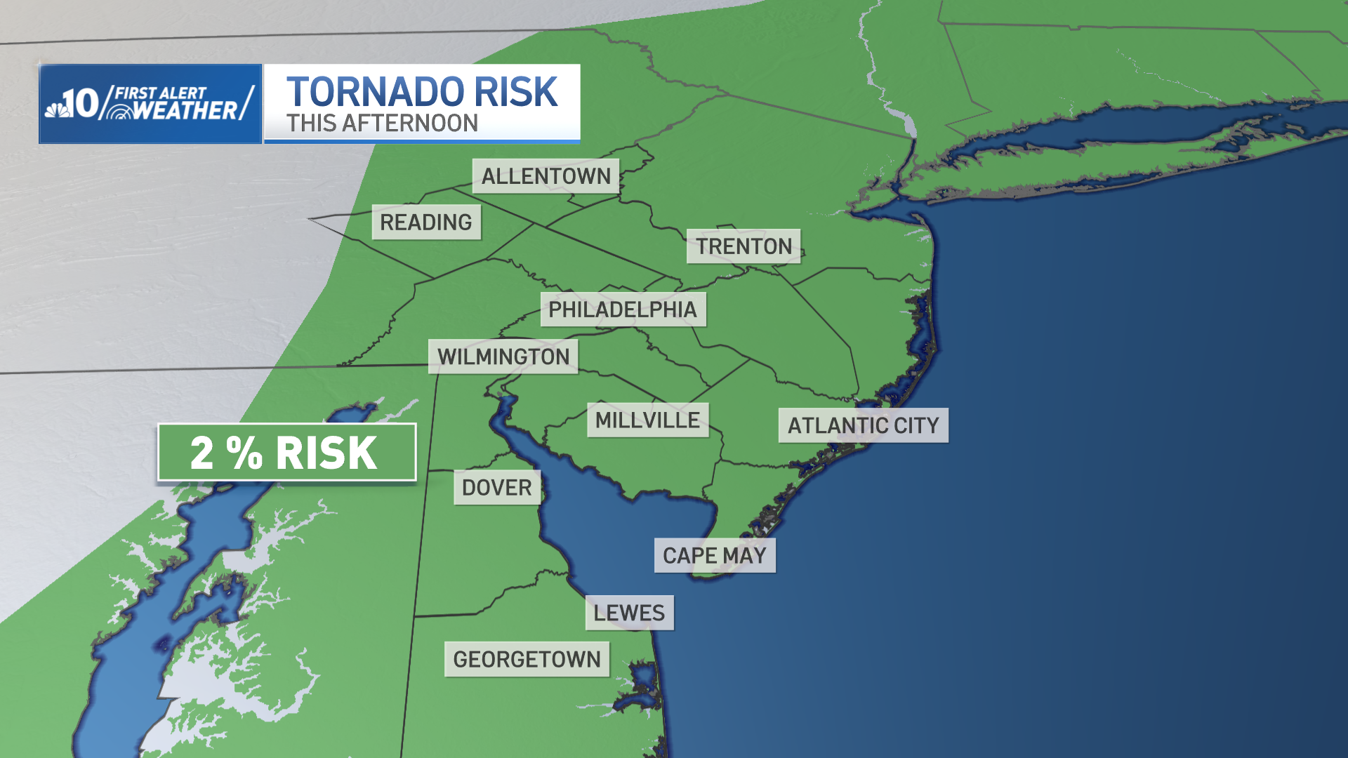
The biggest concern for these storms on Sunday was a high potential of causing wind damage. This system had the highest likelihood of producing a tornado that we've seen so far this season. There was a 1 to 2% tornado risk.
Be weather aware
Be sure to keep watching NBC10 News and have the most updated version of the NBC10 app downloaded to your device to get the latest weather forecasts and conditions in real-time.
Should you be in the path of a tornado warning, seek shelter immediately in a basement of interior room with no windows until the threat passes.
People should make sure to weigh down outdoor furniture and trashcans. You should also be prepared for possible power outages.
Sign up for our Breaking newsletter to get the most urgent news stories in your inbox.

