
What to Know
- Super Bowl weekend in Philadelphia has brought a mix of weather -- mostly ice and sleet -- to the region on Sunday.
- A First Alert for wintry weather was in effect until 1 a.m. Sunday for the Philadelphia region.
- Luckily, skies are expected to clear in plenty of time for folks to enjoy Super Bowl parties.
Super Bowl weekend is upon us and a wet, winter winter storm has settled over the area.
But, the skies look clear for the big game.
The NBC10 First Alert Weather Team issued a First Alert for the entire region for a winter storm that lasted until 1 a.m. on Sunday morning.
Get top local stories in Philly delivered to you every morning. Sign up for NBC Philadelphia's News Headlines newsletter.
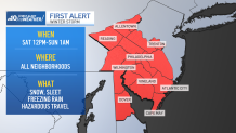
The National Weather Service also issued a Winter Weather Advisory for the region.
What did Saturday's Winter storm bring?
Weather Stories
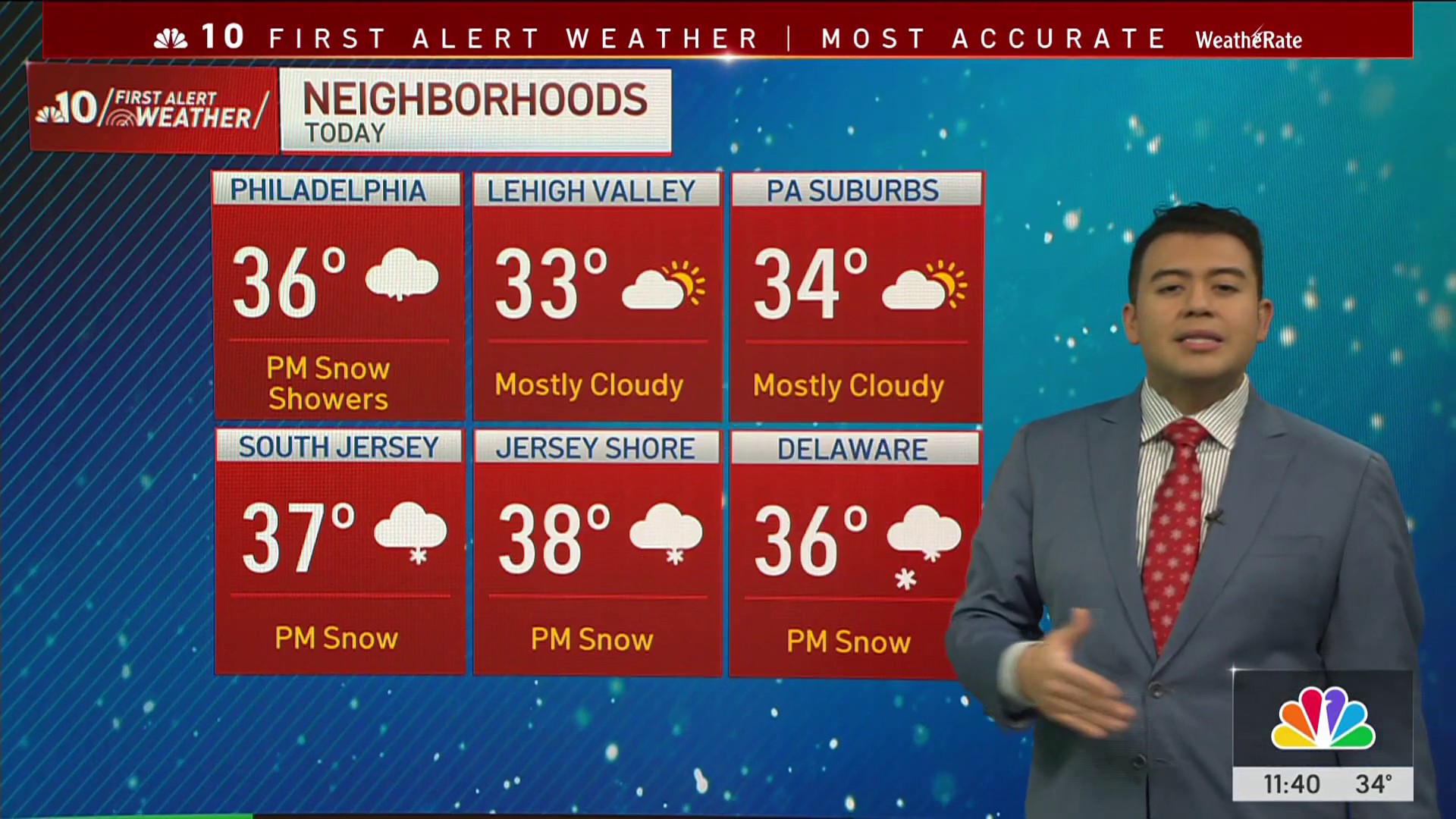
The storm overnight Saturday brought a mix of snow, sleet, and freezing rain before transitioning to plain rain in some areas.
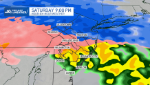
The first half of Saturday was dry, but as a low-pressure system moved in, precipitation spread from south to north by the evening.
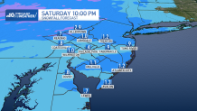
A quick burst of sleet and ice settled in once the storm arrived, followed by a gradual change to sleet and freezing rain for much of Saturday evening, especially along the I-95 corridor and areas north and west.
How much snow fell?
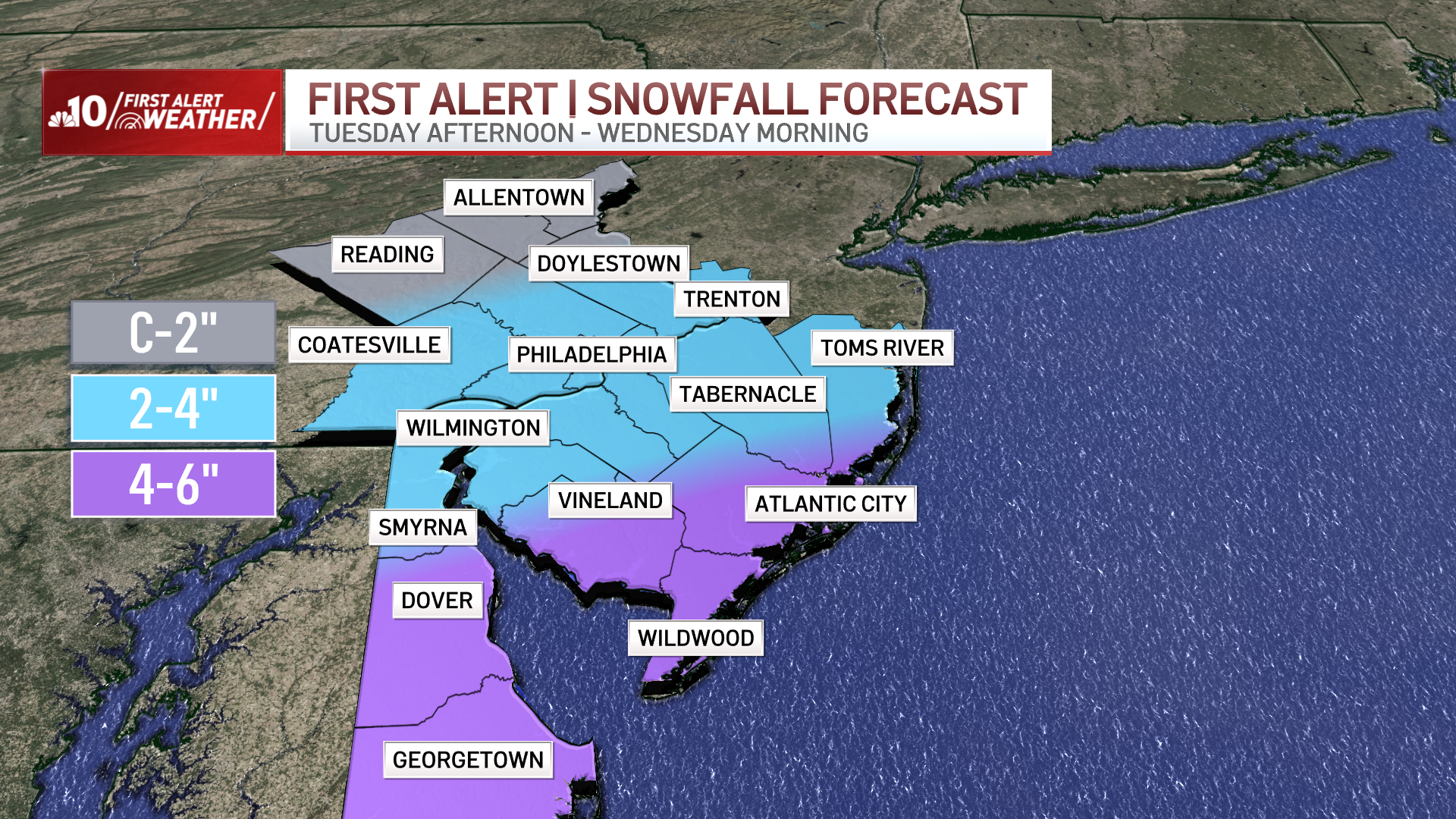
Snow totals of 1 to 3 inches were expected across the Pennsylvania Turnpike north into the Lehigh Valley, while Philadelphia and areas south saw little to no snow.
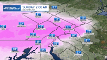
The bigger concern could be the ice
As snow transitioned to sleet and freezing rain, accumulating ice led to hazardous travel conditions on Saturday evening. Anyone heading out early Sunday morning likely had to deal with a quarter inch of ice (or more) of ice on their vehicles and in the roads.
The best bet is to be careful if you have to drive or walk anywhere and give yourself time. You might just want to take it easy and prepare for Super Bowl Sunday.
Clearing out for Super Bowl Sunday
By early Sunday morning, temperatures rose, and precipitation will wrap up. Sunday will be partly sunny and dry, but gusty winds up to 30 mph will make for a blustery afternoon.
Dry weather is expected to continue through Sunday night and Monday. Then the next winter storm could hit Tuesday, so stay tuned.
Be sure to have the latest version of the NBC10 app downloaded to your device for the latest forecast and weather alerts as ice storms can lead to power outages.
Sign up for our Breaking newsletter to get the most urgent news stories in your inbox.