The heat wave has ended. We’re tracking rain before the week is over and possibly into the weekend. NBC10 meteorologist Sheena Parveen has your full 7-day forecast.
POSSIBLE NOR’EASTER
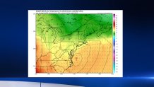
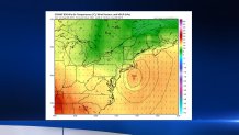
Instead of a simple storm tracking south of the Philadelphia area Friday, we may see something stronger, slower, windier, and wetter. And the area most affected would be the Jersey Shore and Delaware Beaches. Anyone planning a trip this weekend should be aware of possible changing forecasts (in any event, Sunday looks nice).
WHICH MODEL TO ROOT FOR
As we’ve said many times, there are a lot of different computer forecast models, from all over the world. They show future weather patterns, and even specific things like temperatures and amounts of rain. When they all agree, we can have a lot of confidence in our forecasts. When they disagree, like now, we can do one of three things:
- Pick the model we believe is going to be best
- Take an average of the all the models
- If the models fall into two different “camps” (for example, one tracking out to sea and one more up the coast), pick the general answer and then average the models in that “camp."
Local
Breaking news and the stories that matter to your neighborhood.


The other “camp” consists of the GFS, Canadian, RPM, JMA, and NAM (and others). They have the storm weaker and faster, and track it farther east. (“YEA!!!!!!”) If they’re right, the storm moves more out to sea, leaving us with a nice Saturday. Our “confirmation bias” wants this solution to be right for two reasons: it would be similar to yesterday’s forecast; and none of us like rain on summer weekends, especially at the shore.
The models are run every 3, 6 or 12 hours, depending on the model. So there are several model runs to go before the weekend. Feel free to root for your favorites.


